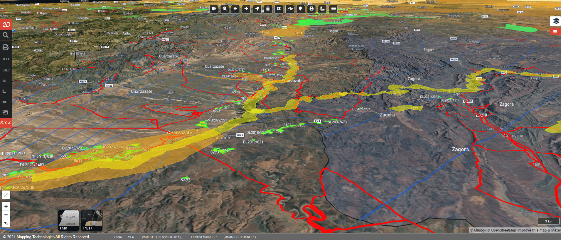
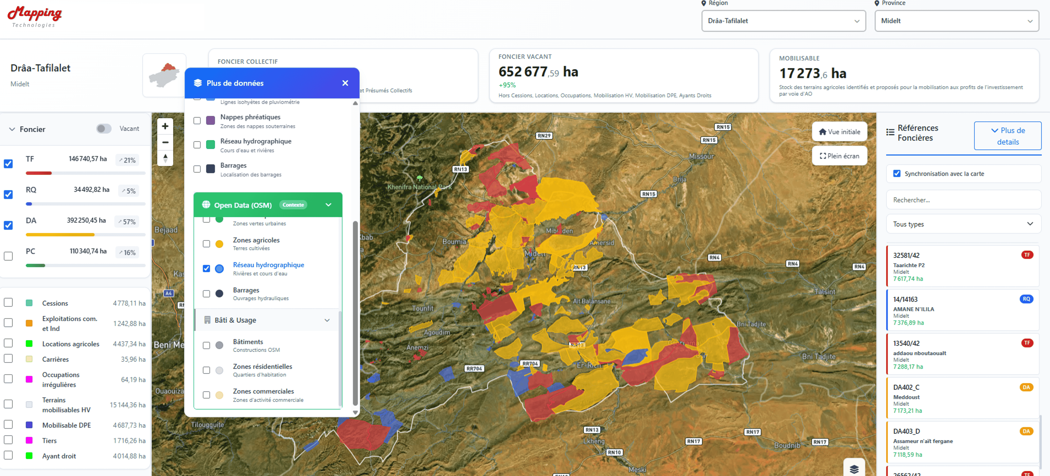
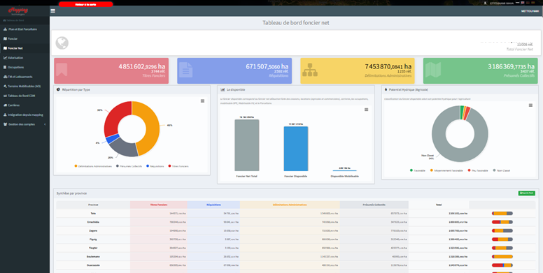
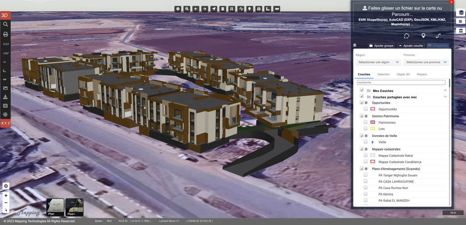
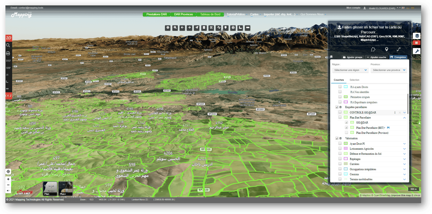
Mapping.Tools is a modern web-based GIS (Geographic Information System) platform designed to transform complex geospatial data into actionable insights for decision-makers. Built for both public and private sectors, the solution emphasizes usability, scalability, and interoperability, enabling organizations to leverage spatial intelligence without requiring advanced technical expertise.
As a Full-Stack Developer on this project, I contributed to the design and development of a robust, cloud-ready application that allows users to visualize, analyze, and manage geographic data through an intuitive interface. The platform supports interactive mapping, real-time spatial analysis, customizable dashboards, and collaborative workflows, making it suitable for urban planning, infrastructure management, environmental monitoring, and business intelligence.